Our range of Map marketing covers all the essentials needs that every office has for them, if you can not find the supplies that you are looking for please feel to contact us here at Office Stationery.
5% off Map Marketing products
Claim Code > mapmarketing5offFree Haribo when you buy Map Marketing products
Free Haribo when you buy Map Marketing products
Map Marketing Postcode Areas Map Unframed 12.5 Miles to 1 inch Scale W830xH1200mm BIPA
A wall map of the UK (incl. N Ireland) showing the postcode area boundaries and the C...
SAVE 26% off RRP
Only £28.45 inc VAT£28.45 exc VAT
Product Code: 05336X
Stock: 33
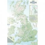
Next Day DeliveryMap Marketing British Isles Motoring Map Unframed 12.5 Miles to 1 inch Scale W830xH1200mm BIM
A road map of the UK and Ireland showing all motorways and 'A' roads....
SAVE 41% off RRP
Only £22.91 inc VAT£22.91 exc VAT
Product Code: 05322X
Stock: 17
Next Day DeliveryMap Marketing British Isles Motoring Laminated Map BIM
With every motorway and A-road included, plus shaded relief colouring for terrain, it
SAVE 37% off RRP
Only £24.00 inc VAT£24.00 exc VAT
Product Code: MM90401
Stock: 11
Map Marketing Postal Districts of London Map Unframed 1 Mile to 1 inch Scale W1180xH930mm GLPC
Greater London postcode wall map....
SAVE 19% off RRP
Only £31.11 inc VAT£31.11 exc VAT
Product Code: 053378
Stock: 8
Next Day DeliveryMap Marketing World Map 3D Effect Giant Unframed 315 Miles to 1 inch Scale W1840xH1200mm GWLD
Giant political wall map of the world....
SAVE 49% off RRP
Only £35.14 inc VAT£35.14 exc VAT
Product Code: 388289
Stock: 5
Next Day DeliveryMap Marketing Giant World Political Laminated Map GWLD
This map displays political boundaries, major cities in five population bands, terrai
SAVE 40% off RRP
Only £38.88 inc VAT£38.88 exc VAT
Product Code: MM05271
Stock: out of stock
Browse products from Map marketing that are no longer part of our available inventory.
- 5015822075711 rrp £12.39
One side features bold delineation of postcode districts plus roads, rail and Underground stations alongside the Low Emission Zone and Congestion Zone. Flip it over and there's a colour-coded London borough map. This map covers all of Greater London, plus large areas of the Home Counties, and is laminated for extra protection from those awkward co - 5015822018312 rrp £30.41
LAMINATED MAPS: Permanently bonded between two sheets of tough, flexible, crystal clear plastic making them virtually indestructible. It also gives the map surface a dry or white finish allowing you to update information at a stroke. Main roads and mileages shown, with both road and contour colouring. WxH: 830x1200mm. Scale - 12.5 miles: 1 inch. LA - 5015822904035 rrp £90.78
LAMINATED MAPS: Permanently bonded between two sheets of tough, flexible, crystal clear plastic making them virtually indestructible. It also gives the map surface a dry or white finish allowing you to update information at a stroke. Detailed single sheet 4-colour map of the counties and regions of the UK and Eire including population. Scale - 12.5 - 5015822901010 rrp £34.08
Laminated Europe Political Map. Very comprehensive map that covers the whole of Europe and the north cape. Features cities, roads, airports, canals, railways and rivers. Size: 102x112cm (40x44). Scale 1:3,7500,000 (60 miles = 1 inch). Covers the whole of Europe as far as Moscow to the east, and south to North Africa Key/legend shown in six languag - 5015822401015 rrp £34.08
LAMINATED MAPS: Permanently bonded between two sheets of tough, flexible, crystal clear plastic making them virtually indestructible. It also gives the map surface a dry or white finish allowing you to update information at a stroke. Detailed single sheet 4-colour map of the counties and regions of the UK and Eire including population. WxH: 830x120 - 5015822011788 rrp £106.80
LAMINATED MAPS: Permanently bonded between two sheets of tough, flexible, crystal clear plastic making them virtually indestructible. It also gives the map surface a dry or white finish allowing you to update information at a stroke. Detailed 4-colour single sheet map of UK (GB and N Ireland) showing postcode area letters on a background map showin - 5015822903038 rrp £106.80
LAMINATED MAPS: Permanently bonded between two sheets of tough, flexible, crystal clear plastic making them virtually indestructible. It also gives the map surface a dry or white finish allowing you to update information at a stroke. Countries clearly defined with political colouring. Mountain ranges indicated by subtle hill shading. Main cities ma - 5015822300035 rrp £106.80
This map displays political boundaries, major cities in five population bands, terrain and ocean depth relief, and roads and railways. Updated to reflect the latest boundaries, including the new state of South Sudan. The map comes framed in a stylish, satin finish aluminium frame and is supplied ready to display. This giant map measures W1840 x H12 - 5015822001734 rrp £158.87
It displays an easy colour-coded map of all the counties and provinces across Ireland, as well as cities and towns. Two handy inset boxes show the city centre layout of Dublin and Belfast. This map is laminated on both sides, making it a great choice for adding annotations with drywipe markers but also ensuring that any unplanned spills or leakage - 5015822045516 rrp £30.41
Double-sized, this dated year planner has extra large boxes allowing far more information to be displayed. Colour tints help to visually separate one week from the next. Now features the 52 weeks clearly labelled in addition to public holiday dates for all European Union member states enabling you to organise your business in advance. Use the 2016 - rrp £13.01
Double-sized, this dated year planner has extra large boxes allowing far more information to be displayed. Colour tints help to visually separate one week from the next. Now features the 52 weeks clearly labelled in addition to public holiday dates for all European Union member states enabling you to organise your business in advance. Use the 2017 - rrp £13.01
LAMINATED MAPS: Permanently bonded between two sheets of tough, flexible, crystal clear plastic making them virtually indestructible. It also gives the map surface a dry or white finish allowing you to update information at a stroke. Detailed single sheet 4-colour map of Great Britain and Northern Ireland, showing county and regional boundaries, pr - 5015822900013 rrp £32.79
It includes every administrative division in the UK clearly labelled and coloured, plus major roads and settlements from villages to cities. Also included are insets for London and its boroughs, Ireland, the Northern Isles, Channel Islands and postcode area boundaries. With the laminated finish you can add notes or memos with a drywipe pen and als - 5015822901010 rrp £30.41
This map shows the clear boundaries of every postcode area, plus their corresponding letters, and includes a handy index to rapidly find any postcode area on the map by letter. It also provides information on the structure of a postcode for reference. It also provides boundaries for counties and unitary authorities, correct as of the most recent ad - 5015822903014 rrp £37.89
Updated to include South Sudan, it clearly shows international and internal boundaries as well as major airports, seaports, railways and time zones. A large panel along the bottom provides vital statistics for each country including flag and population. With the clear laminate surface it's great for use in classrooms for adding annotations. This m - 5015822300011 rrp £30.41
LAMINATED MAPS: Permanently bonded between two sheets of tough, flexible, crystal clear plastic making them virtually indestructible. It also gives the map surface a dry or white finish allowing you to update information at a stroke. Countries clearly defined with political colouring. Mountain ranges indicated by subtle hill shading. Main cities ma - 5015822300011 rrp £34.08
This giant wall planner is ideal for use in any office workplace or even in the home. With extra large day boxes - 5015822091711 rrp £0.11